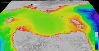
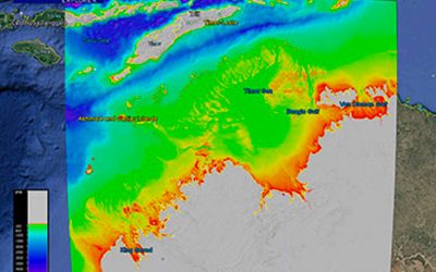
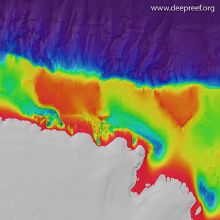
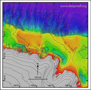
This dataset provides the high-resolution bathymetry model for the Terre Adelie and George V continental margin, East Antarctica, called gvdem (short for George V digital elevation model). The ~100 metre-resolution gridded bathymetry dataset covers an area of about 302,000 km2, which also includes the land and ice sheet elevation coverage. This page provides the data in a range of formats for public download.
NOT TO BE USED FOR NAVIGATION.
If using the data for publications, please quote the following reference:
- Beaman, R.J., O’Brien, P.E., Post, A.L., and De Santis, L., 2011, A new high-resolution bathymetry model for the Terre Adélie and George V continental margin, East Antarctica: Antarctic Science 23(1), 95-103. (internal link to paper)
Gallery images
 |
|
 |
Google Earth
 |
GeoTIFF hillshade
 |
Grid data (V3, 11 May 2011)
 |
|
Line data
 |
Metadata