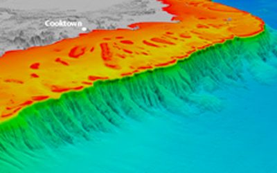
The ocean floor is the Earth’s last great frontier, full of great mountain ranges and deep chasms that are largely unexplored. Just 150-600 km east of the Australian mainland is a 2000 km long chain of submerged volcanoes that rise over 4000 m above the seafloor – nearly twice the height of the highest mountain on the mainland. These undersea mountains, the Tasmantid Seamounts, are extinct volcanoes formed from around 40 to 6 million years ago above a mantle hotspot, similar to the Hawaiian Islands.
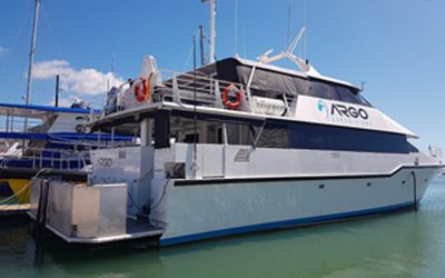
 View of RV Southern Surveyor deck
In 2012, an expedition of the Australian Marine National Facility vessel, the RV Southern Surveyor, mapped the seafloor and sampled rocks from the Tasmantid volcanoes. About 16,000 km2 was mapped over 16 volcanoes, representing an area seven times as large as the Australian Capital Territory or half the size of Belgium. The multibeam sonar data revealed details such as volcanic cones, craters, volcanic ridges, lava flows, sinkholes, canyons and ancient coral reefs.
26 days were spent at sea, with the ship departing from Brisbane and travelling along the seamounts in the Tasman and Coral Seas for about 800 km before returning to Brisbane. The expedition was led by Benjamin Cohen from University of Queensland, now at University of Glasgow, and Lara Kalnins from University of Oxford, now at Durham University, with staff and students from University of Queensland. Since the expedition, scientists at James Cook University, University of Tasmania and the Australian National University have also joined the team.
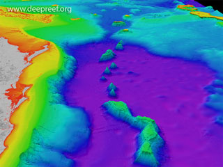 3D view of the Tasmantid SeamountsBack in the lab, the rock samples collected will allow marine scientists to address questions such as the ages of the volcanoes and their eruptive history. The expedition also obtained fossilised organisms, including shallow- and deep-water coral rocks, as well as a variety of live deep-water biota. These samples provide an important biological and climatic record of the seas east of Australia.
In addition to the rocks and maps, while the ship was at sea it continuously recorded weather data, such as air and water temperature, wind speed, and humidity. These datasets, from remote parts of the Coral Sea, were sent to the Bureau of Meteorology for their weather forecasts. The velocities of oceanic currents, including the East Australian Current, were also measured – these datasets can be used for oceanographic research.
As a result of this expedition we now have a better understanding of the submarine volcanism that occurred off eastern Australia, as well as the ancient and modern marine life on these seamounts. The detailed maps of the Tasmantid Seamounts in the Coral Sea and Temperate East Commonwealth Marine Reserves, and in the Great Barrier Reef Marine Park, are also important for the future management of these highly biodiverse marine regions.

Brittle Star

Britannia Seamount

Brisbane Seamount

Basalt Sample

Tasmantid Seamounts

Rock Dredge

Sunset in Coral Sea

Wreck Reefs

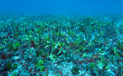
Coldwater Corals

Shrunk styrofoam cups

Cato Island Wreck

Deck Work
Movie
- Conference paper – Interactions between tectonic inheritance and magmatic evolution
- Conference paper – A window into the structural inheritance of ocean floor fabric
- Peer-reviewed literature – The morphology of the Tasmantid Seamounts: Interactions between tectonic inheritance and magmatic evolution
- YouTube movie – Tracing the Ancestors of Lord Howe Island