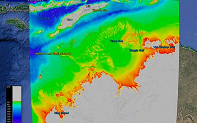
This dataset provides the new high-resolution bathymetry model for the Bass Strait, called the bs100 grid. The ~100 metre-resolution gridded bathymetry dataset covers an area of about 334,000 km2, from King Island in the west of Bass Strait to Flinders Island in the east, and from northern Tasmania to the Victoria and southern NSW coast. This page provides the data in a range of formats for public download.
NOT TO BE USED FOR NAVIGATION.
Gallery images
 |
|
 |
|
 |
Google Earth
 |
GeoTIFF hillshade
 |
Grid data (V1, 29 January 2022)
 |
|
Line data
 |
Metadata