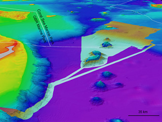
From 16 to 22 July 2026, I led a seabed mapping voyage aboard CSIRO’s research vessel RV Investigator, conducting multibeam bathymetric surveys during a transit from Hobart to Brisbane across approximately 2,200 km of the Tasman Sea. The mapping team brought together specialists from Geoscience Australia, the Royal Australian Navy, and James Cook University.
This voyage marked the first offshore data acquisition activity under the Australian Government’s Resourcing Australia’s Prosperity initiative, a major national program designed to improve understanding of Australia’s resource potential and support informed decision-making for future resource development.
The survey focused on collecting high-resolution bathymetric data across a section of the Tasman Sea basin where existing seabed information remains relatively sparse and of lower quality, despite the area being regularly traversed by commercial and research vessels.
The newly acquired data will contribute to improving Australia’s knowledge of the deep-ocean seafloor and will be incorporated into the Australian Bathymetry and Topography (AusBathyTopo) Grid, the nation’s flagship bathymetric dataset. These updates will provide a more accurate representation of the seabed, supporting marine science, resource assessment, environmental management, and maritime operations.
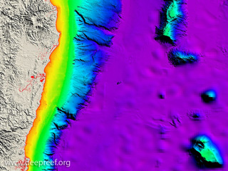
3D view of Tasman Sea basin