
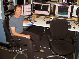
Rob’s Blog
Recent ocean mapping events within Australia’s marine region.

Hydrography as a career for the modern explorer
Hydrography is the branch of applied sciences which measures and describes the physical features of the oceans and adjacent coastal areas, particularly for the purpose of navigation. Hydrographic surveyors measure the depth and configuration of water bodies, and the...
Search for drowned reefs on the Great Barrier Reef
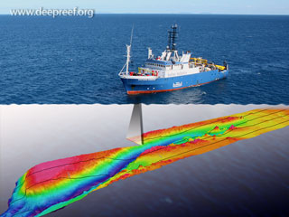
We have just completed a two week voyage around the top of Australia and along the Great Barrier Reef shelf edge on the RV Southern Surveyor, Australia’s largest research vessel. The voyage from Broome to Brisbane was to explore and study the geographic limits of the...
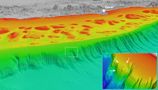
German-Australian collaboration maps the Coral Sea
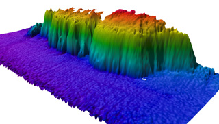
An underwater cliff recently discovered in the Coral Sea will help shed light on the ancient past, and could also prove to be a hotspot of marine life diversity. The steep, 800-metre cliff is on the western edge of the Queensland Plateau, to the northeast of Cooktown....
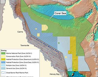
Coral Sea Commonwealth Marine Reserve Management Plan
In the Parliament of Australia House of Representatives, a Private Member's Business motion was presented that the Coral Sea Commonwealth Marine Reserves Network Management Plan 2014-2024, made under section 370 of the Environment Protection and Biodiversity...

Workshop on Coral Sea Transboundary Collaboration
Australia and New Caledonia share a maritime boundary in the Coral Sea where their Exclusive Economic Zones (EEZs) meet. A Declaration of Intentions between France-New Caledonia and Australia on the Sustainable Management of the Coral Sea aims to improve scientific...
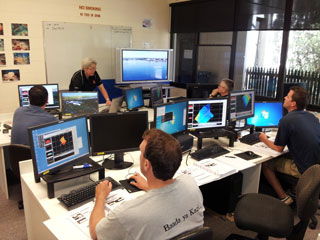
Kongsberg multibeam workshop in Deakin University
Deakin University in Warnambool, Victoria, has a 10 metre research vessel, MV Yolla, which also has a Kongsberg EM3002 multibeam swath system used for seabed mapping surveys in shallow coastal waters. It will soon have as a replacement the Kongsberg EM2040C...
Underwater landslides discovered off the Great Barrier Reef
An extensive undersea mapping program of the Australian coast has revealed some surprises about the deep Great Barrier Reef, including a dense network of submarine canyons, the remains of numerous undersea landslide scarps where large parts of the continental slope...
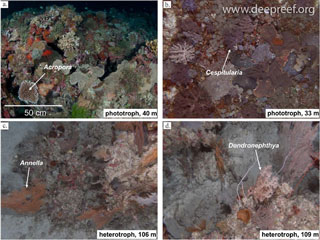
Predictive modelling of submerged coral reefs
Coral reef communities occurring in deeper waters have received little research effort compared to their shallow-water counterparts, and even such basic information as their location and extent are currently unknown throughout most of the world. In a scientific...
Searching for a new end to the Great Barrier Reef
James Cook University’s Robin Beaman will lead a joint JCU/University of Sydney research voyage to test whether long-term climate change could see the Great Barrier Reef head south. Dr Beaman’s team will use multibeam mapping and rock dredging equipment onboard the...