
Rob’s Blog
Recent ocean mapping events within Australia’s marine region.
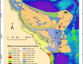
New map details reefs, mountains and canyons of Coral Sea
James Cook University’s Robin Beaman has produced a new map of Australia’s Coral Sea region that details the reefs, mountains, and canyons that exist under the sea. A marine geologist at JCU’s School of Earth and Environmental Sciences, Dr Beaman’s map covers an area...
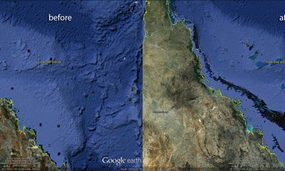
Contribution to new Google Earth underwater terrain
On 2 February 2012, Google Earth announced a major update to the underwater terrain dataset used to show the ocean topography. The update covers seafloor topography from all over the globe and reveals the most accurate 3D view of the ocean seafloor to date. The Google...
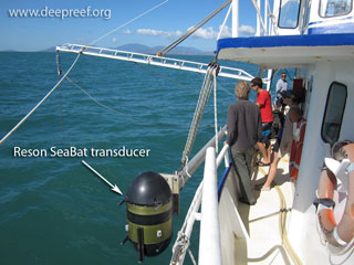
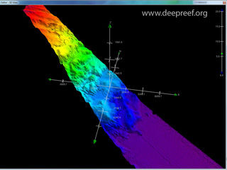
Multibeam training workshop in JCU-Townsville
James Cook University has a 19 metre research vessel, RV James Kirby, which also has a Reson SeaBat 8101 multibeam swath system used for seabed mapping surveys. A multibeam echosounder provides dense bathymetry (depth) data for visualising the seafloor in...
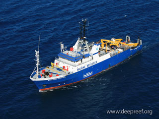
RV Sonne bathymetry survey across the Coral Sea
The 97 metre long RV Sonne is based out of Bremen, Germany but roams the world’s oceans doing mainly geoscience research. The vessel has one of the best deep-water multibeam mapping systems in the world, a Kongsberg Simrad EM120. From 2-18 June 2011, the Sonne...
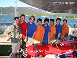
PICASSO-1 studies Osprey Reef
PICASSO-1 stands for Plankton Investigatory Collaborating Autonomous Survey System Operon-1. It is an untethered remotely operated vehicle (uROV) used for studying plankton and other deep sea organisms at a range of sizes using imaging tools, such as a high definition...
Award of ‘Next Wave’ Transit voyage, Brisbane to Lautoka
The 'Next Wave' Transit voyages are conducted each year onboard Australia's largest blue-water research vessel, RV Southern Surveyor. Applications are invited by marine scientists to carry out underway or opportunistic science during transits between voyages and...
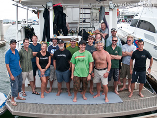
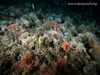
Mesophotic Coral Ecosystems in the Coral Sea expedition
Mesophotic coral ecosystems (MCEs) are coral communities that exist in the twilight zone (about 30 to 150 metres) on tropical reefs. Modern exploration tools, such as remote operated vehicles (ROVs), autonomous underwater vehicles (AUVs) and deep technical diving...
GeoHab 2010 Conference in Wellington, New Zealand
The annual GeoHab (Marine Geological and Biological Habitat Mapping) Conference was held this year in Wellington, New Zealand, and hosted by the National Institute of Water and Atmospheric Research (NIWA). With the theme 'Characterisation, Quantification and Diversity...
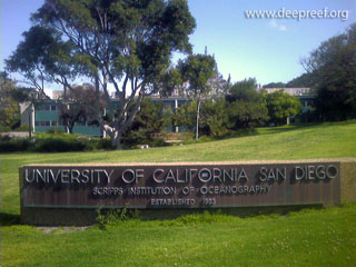
Collaboration with Scripps Institution of Oceanography
Prof David Sandwell at Scripps Institution of Oceanography (SIO) is one of the world’s foremost experts in mapping the seafloor using satellite gravity data. He and his colleagues have developed the Global and Estimated Seafloor Topography dataset (Satellite Geodesy)...