
Rob’s Blog
Recent ocean mapping events within Australia’s marine region.
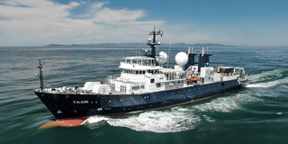
RV Falkor is coming to Australia
Schmidt Ocean Institute (SOI) research vessel Falkor is coming to Australia for most of 2020, with a series of exciting projects that range from studying deepsea canyons, mesophotic coral ecosystems, undersea landslides and microplastics. See the list of cruises at:...
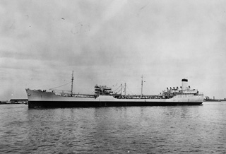
Scientists think they’ve found Aussie defender’s last resting place
A James Cook University scientist believes his team may have found the wreck of a US warship sunk defending Australia more than 77 years ago during WWII. USS Neosho in 1939JCU marine geologist Dr Robin Beaman led a mapping team based on the CSIRO’s research vessel...

ESRI Story Map – James Cook and Cape York, Australia
In 1770 during Lieut James Cook's exploration of Australia's east coast, the vessel Endeavour ran aground on a coral reef offshore of southern Cape York, which he called 'The Labyrinth' - today known as the Great Barrier Reef. ESRI Story Map - James Cook and Cape...

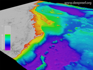
How a handful of USB sticks are revealing the secrets of the GBR
Read the full story "How a handful of USB sticks are revealing the secrets of the Great Barrier Reef", published by Computerworld on 07 June 2019. 3D view of Hook and Line ReefsDr Robin Beaman from James Cook University was interviewed by George Nott on the...
Pint of Science – Mapping the deep GBR
The Pint of Science Festival was held across Australia from 11-13 May 2019. Dr Robin Beaman presented a talk on "Mapping the deep Great Barrier Reef" at the Macalister Brewing Company in Cairns. Great Barrier Reef in 3DMore than 75% of the GBR World Heritage Area lies...

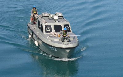
Citizen scientists to help map the Reef
James Cook University is calling for volunteers to help map the seafloor around the Great Barrier Reef to better protect the natural icon. MV ARGO volunteer vessel in CairnsJCU marine geologist Dr Robin Beaman said the Royal Australian Navy does great work mapping the...
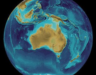
Seeing more of Australia’s seafloor
Fields of hidden volcanoes, canyons that cut through the continental shelf and oceanic plateaus that rise more than a thousand metres from the deep sea to the surface are just some of the features revealed in never-before-seen detail by new high-resolution bathymetry...
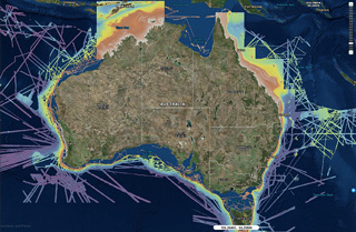
GEBCO Symposium in Canberra
The annual Map the Gaps GEBCO Symposium on Bathymetry was held in Canberra, and hosted by Geoscience Australia and Land Information New Zealand. bathymetry of Australia region, GEBCO grid Two days of meetings preceded the Symposium, for the GEBCO Technical...
The Future of Hydrography
Fugro, a global offshore and onshore geotechnical and survey services company, has developed an excellent YouTube video called 'The Future of Hydrography'. Additional media Hydro 2018 Conference and Trade Exhibition in Sydney on 30 Oct to 1 Nov 2018 GEBCO Symposium in...