
Rob’s Blog
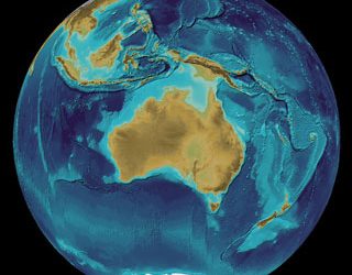
Recent ocean mapping events within Australia’s marine region.

Largest undersea landslide revealed on the Great Barrier Reef
James Cook University scientists have helped discover the remnants of a massive undersea landslide on the Great Barrier Reef, approximately 30 times the volume of Uluru. 3D view of the Gloria Knolls SlideJCU’s Dr Robin Beaman said the remains of the slip, known as the...
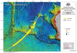
MH370 search data will be treasure trove for scientists
It cost A$200 million (S$215 million) - and ended in apparent failure - but experts say the two-year search for the missing Malaysia Airlines MH370 aircraft was not in vain. According to marine scientists, the 120,000 sq km search for the Boeing 777 has produced an...

Reef mapping by Kathy McLeish ABC
The Great Barrier Reef is one of the world's most studied ecosystems, but its depths still hold many surprises. Some of those could help scientists understand how the reef could have responded to past climate change events, and how resilient it might be in the future....
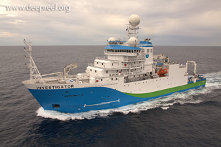
On board the ‘super science ship’ uncovering secrets of the deep
Take a tour of Australia's newest research vessel—the 94-metre-long, 10-storey, $120 million RV Investigator. Read the full story "On board the 'super science ship' uncovering secrets of the deep", published by the ABC on 26 September 2016. RV Investigator, courtesy...
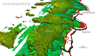
Navy data reveals the reef behind the Reef
James Cook University, University of Sydney and Queensland University of Technology scientists working with laser data from the Royal Australian Navy have revealed a vast reef behind the familiar Great Barrier Reef. bioherms near Bligh Reef, Cape YorkJCU’s Dr Robin...
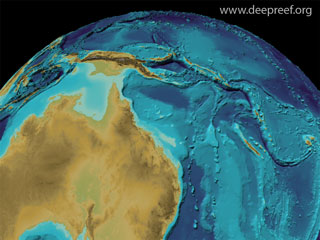
Ocean floor to be mapped by 2030
The first Forum for Future of the Ocean Floor Mapping was held in Monaco from 15 to 17 June 2016. Some 200 delegates gathered, under the flag of General Bathymetric Chart of the Oceans (GEBCO), to discuss the future of the mapping of the ocean floor, aiming to come up...
How deep are the oceans?
In the beginning, systematic mapping of ocean depth was conducted mainly for the safety of shipping routes and remained very limited in its scope. Now, however, better maps of the ocean floor are needed for a wide variety of applications, including coastal protection,...
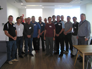
Tides Workshop at Bureau of Meteorology Adelaide
The Tidal Unit, Bureau of Meteorology conducted their Tides Workshop in Adelaide from 16 to 18 May 2016. The Permanent Committee for Tides and Mean Sea Level (PCTMSL) and BOM sponsored the tides workshop, aiming to raise the level of tidal knowledge of those people...

Cairns hotel beer garden to toast Reef premiere
The long-awaited premiere of Sir David Attenborough’s landmark documentary about the Great Barrier Reef will take place in true Far North Queensland style in the beer garden of a Cairns pub. The Courthouse Hotel will host a special screening of the documentary on its...