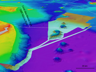
A new 3D bathymetry (or depth) model for the Torres Strait has been released. We can now see the seabed in unprecedented detail, where islands and reefs drop off into the deeper waters to the east.
I am proud to have led the team that developed this 3D depth model, which includes James Cook University, Geoscience Australia and the Australian Hydrographic Office.
This 3D depth model is dedicated to all the hydrographic surveyors who worked to make the Torres Strait safer for mariners.

Torres Strait 3D depth model