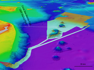
What does one month of continuous mapping with Schmidt Ocean Institute’s RV Falkor look like? Try 40,000 sq km of new map data in Australia’s Tasman and Coral seas, and contributing to the global Seabed 2030 Project.
Link to final report below.

3D view of map in Tasman and Coral seas