
Rob’s Blog
Recent ocean mapping events within Australia’s marine region.
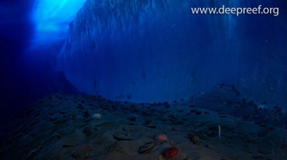
It’s All Academic: mapping the ocean floor
Dr Robin Beaman is a marine geoscientist from James Cook University, who is working to map Australia's underwater landscape. He started out in the navy, but quickly realised he wanted to take his passion further. Today he specialises in the deep Great Barrier Reef and...
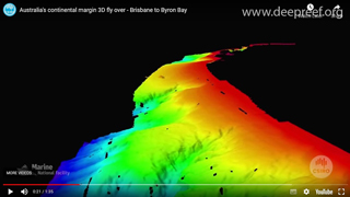
Australia’s continental margin – Brisbane to Byron Bay fly over
Associate Professor Tom Hubble from the University of Sydney’s School of Geosciences has utilised the sonar systems on the CSIRO’s former Marine National Facility vessel Southern Surveyor to map the continental margin and undertake research into landslides and...
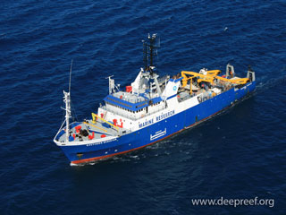
Southern Surveyor: Stories from on board Australia’s ocean research vessel
Over the course of a year, one of Australia’s best non-fiction writers Michael Veitch, interviewed the men and women who worked on board CSIRO’s Marine National Facility research vessel Southern Surveyor, to produce an engaging and sometimes dramatic account of their...
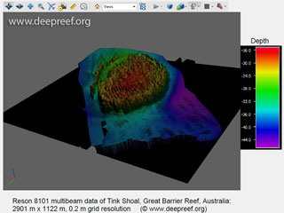
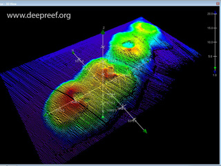
3D PDFs for bathymetry data
There are many free software applications to view 3D bathymetry data, such as the QPS iView4D, CARIS EasyView or FugroViewer. In sharing our 3D geospatial data, we have found there is reluctance by some clients to download these software packages so as to view the...
Submerged volcano cluster found off the coast of Sydney
Australia's new ocean-going research vessel RV Investigator has discovered extinct volcanoes about 250 kilometres off the coast of Sydney in 4,900 metres of water. Professor Richard Arculus, from the ANU Research School of Earth Sciences, an igneous petrologist and a...
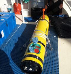
Robotic torpedoes help map our corals on Great Barrier Reef
Robotic torpedoes that are being trialled on the Great Barrier Reef are revolutionising the way scientists view the underwater world. A team of researchers from Macquarie University, the University of Sydney, James Cook University and the University of St Andrews in...
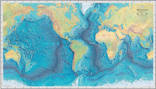
Creating the first map of the world’s ocean floor
The ability to imagine the contours of the ocean floor led cartographer Marie Tharp to forever change our understanding of the forces shaping the planet. Revealed to the world in 1977, this is the first map of the Earth's ocean floor. Today we know more about the...
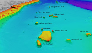
3D satellite mapping of Coral Sea reefs
A James Cook University researcher in Cairns has completed detailed 3D depth maps of Australia’s Coral Sea reefs, shedding new light on the likely distribution of coral diversity and sea life in the area. Reefs and atolls on Queensland PlateauDr Robin Beaman, from...
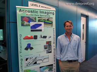
High accuracy multibeam training course at Port of Brisbane
Acoustic Imaging conducted their 3rd Annual High Accuracy Multibeam Training Course in Brisbane from 17 to 21 Nov 2014. Doug and Nicole Bergersen from Acoustic Imaging and Richard Hill from QPS provided the instruction, together with co-hosting from the Port of...