Williams Ridge bathymetry
October 07, 2023

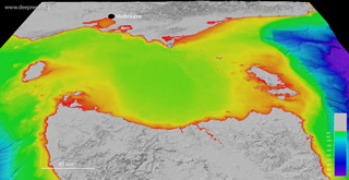
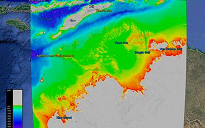
This dataset provides the high-resolution bathymetry model for Williams Ridge, called the wr100 grid. The ~100 metre-resolution gridded bathymetry dataset covers an area of about 660,000 km2, which also includes parts of the Kerguelen Plateau. This page provides the data in a range of formats for public download.

Copyright Notice

NOT TO BE USED FOR NAVIGATION.

    Gallery images

      Movie

      You may also like…

      Bass Strait bathymetry

      Bass Strait bathymetry

      This dataset provides the new high-resolution bathymetry model for the Bass Strait, called the bs100 grid. The ~100...

      Northern Australia bathymetry

      Northern Australia bathymetry

      This dataset provides the new high-resolution bathymetry model for the Northern Australia, called the nthaus100 grid....

      Kerguelen Plateau bathymetry

      Kerguelen Plateau bathymetry

      This dataset provides the high-resolution bathymetry model for the Kerguelen Plateau, called the kerg100 grid. The...