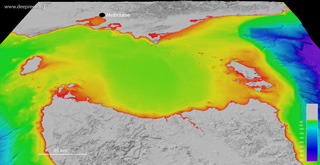
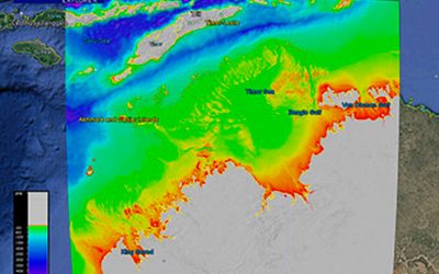
This dataset provides the high-resolution bathymetry model for the Kerguelen Plateau, called the kerg100 grid. The ~100 metre-resolution gridded bathymetry dataset covers an area of about 736,000 km2, which also includes the land elevation coverage for Heard Island and McDonald Island, and Kerguelen Island. This page provides the data in a range of formats for public download.
NOT TO BE USED FOR NAVIGATION.
Additional content (report, data, metadata) can be obtained at the Geoscience Australia website.
If using the data for publications, please quote the following reference:
- Beaman, R.J., and O’Brien, P.E., 2011, Kerguelen Plateau Bathymetric Grid, November 2010. Record 2011/22. Geoscience Australia, Canberra, Australia, pp. 18. (internal link to report)
Gallery images
 |
|
 |
Google Earth
 |
GeoTIFF hillshade
 |
Grid data (V3, 06 November 2022)
 |
|
Line data
 |
Metadata